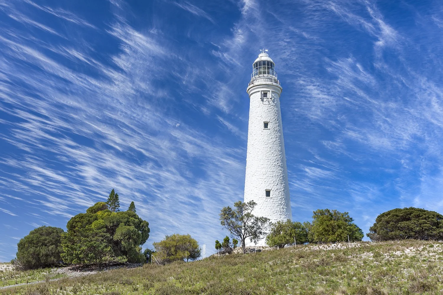
Wadjemup Lighthouse
The central landmark of the island, offering expansive views over the surrounding ocean and interior salt lakes.
View from the base to capture the historic limestone architecture.
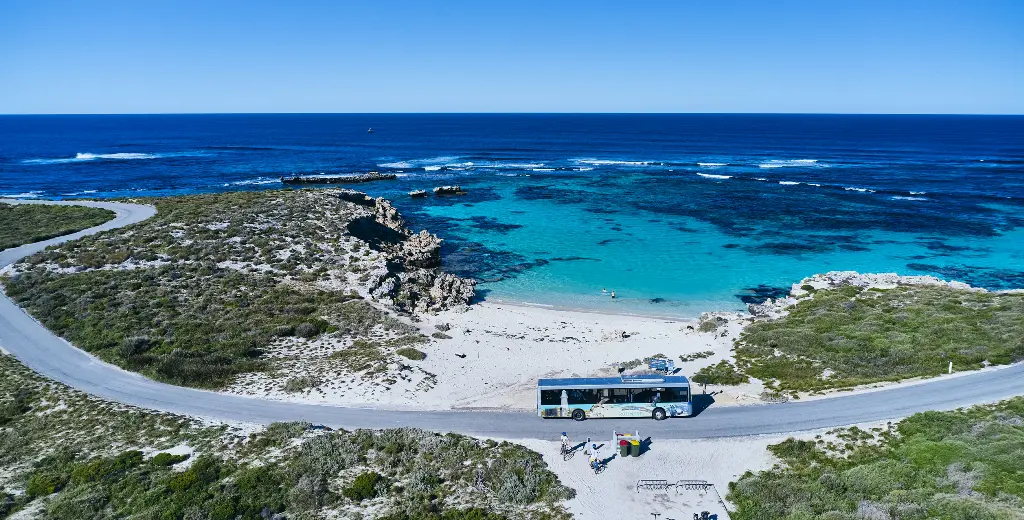
Rottnest sits about 19 kilometres off Fremantle, and its single sealed road loop is served by bus rather than private cars. Reading the island's bus route map before landing shows which bays connect, where the road cuts inland, and how far apart the stops actually are. This page explains how the network is laid out and how to plan around it.
Quick answer
A Rottnest Island bus tour map shows one road circuit around the island, linking Thomson Bay settlement with Geordie Bay, Oliver Hill, Salmon Bay and the West End. Visitor services operate 07:30–17:00 daily, extended to 19:00 on Friday, and day admission is 21.5 AUD per person. Timetables shift with the season, so confirm the day's frequency before planning stops.
Rottnest Island allows almost no private cars. Visitors step off the ferry on foot, and the sealed road ring that circles the island — roughly twenty-two kilometres of it — carries buses, bicycles and service vehicles only. That single constraint explains why a Rottnest Island bus tour map matters more here than at most destinations. The map is not a convenience. It is the transport network, drawn in full. The layout is simple once understood. Everything radiates from the Thomson Bay settlement, where the ferry jetty, the visitor centre and the island's main services sit at 1 Henderson Ave. From there the road runs west along the northern bays — Longreach, Geordie Bay, Little Armstrong — before crossing the island's narrow waist toward Oliver Hill and the Wadjemup Lighthouse. The southern return follows Salmon Bay, Parker Point and Little Salmon Bay. Cape Vlamingh, at the West End, is the turning point: the furthest stop from the settlement, and the one that most reshapes a day's plan. Two features make the island's bus route map worth studying before boarding. The first is distance. Bays that appear adjacent on paper can sit kilometres apart, and walking between them under open coastal sun takes far longer than the scale suggests. The second is frequency. Buses circle the loop at set intervals, so every stop is a commitment to a block of time rather than a casual pause. Quokkas, salt lakes and snorkelling coves each reward a different length of stay, and the loop does not adjust to indecision. Distances that look trivial from a bus seat become substantial on foot. The map's value lies as much in the choices it forecloses as in the ones it opens. Most visitors treat the circuit one of two ways. Some stay aboard for a full lap first, mapping the island by eye, then ride again and step off selectively. Others fix on two or three bays and ignore the remainder. Either method works. Neither survives without reading the Rottnest Island bus tour map against the day's posted timetable, since services thin out later in the afternoon and the last departures from the West End leave earlier than newcomers expect. The Wadjemup coast rewards the visitor who knows, before stepping down, exactly where the next bus is going.
“The map is not a convenience. It is the transport network, drawn in full.”
This sequencing plan suits first-time visitors using a bus tour map to structure a single day on Rottnest, running roughly seven hours from the Thomson Bay settlement back to the same point. It follows the island's clockwise loop so lookouts arrive in a logical order rather than doubling back.
Pick up a route map at the Visitor Centre on Henderson Ave and mark which stops you intend to leave the bus at. Ten minutes here saves guessing later.
Trace the map's first leg past Parker Point and Little Salmon Bay. Note that stop numbers on the map match the signage at each shelter.
The map's midpoint sits at the island's highest ground, where the loop pivots north. Allow around 40 minutes if you walk up to the lighthouse base.
This is the furthest point from the settlement on the map and the natural halfway marker. Budget 30 to 45 minutes before rejoining the loop.
The map's homeward arc passes The Basin and Geordie Bay. Choose one stop rather than two, since waiting for the next bus eats 25 to 30 minutes.
Return to Thomson Bay with the map's remaining unvisited stops circled for a second visit. Leave a buffer before your departure time.
Rottnest Island bus tours depart from the main settlement area, conveniently located within walking distance of the island's primary ferry terminal. Visitors arrive at the Main Jetty and proceed directly to the nearby transit pickup points.
Ferry from Fremantle or Perth to Rottnest Island Main Jetty
Main Jetty to Settlement Bus Pickup Point
Island Explorer bus service departing settlement
For the best experience, plan your visit for the best arrival window of 07:30–10:00. This timing allows you to avoid mid-day heat and large crowds arriving on later ferries.
The facilities supporting bus tour operations on Rottnest Island are open daily. Visitors may access services throughout the week, with extended evening hours available on Fridays.
Standard island bus tours navigate the perimeter of Rottnest Island, providing guided access to key geographical features and protected nature reserves. These stops offer visual context to the island's unique limestone coastline and maritime history.
The central landmark of the island, offering expansive views over the surrounding ocean and interior salt lakes.
View from the base to capture the historic limestone architecture.
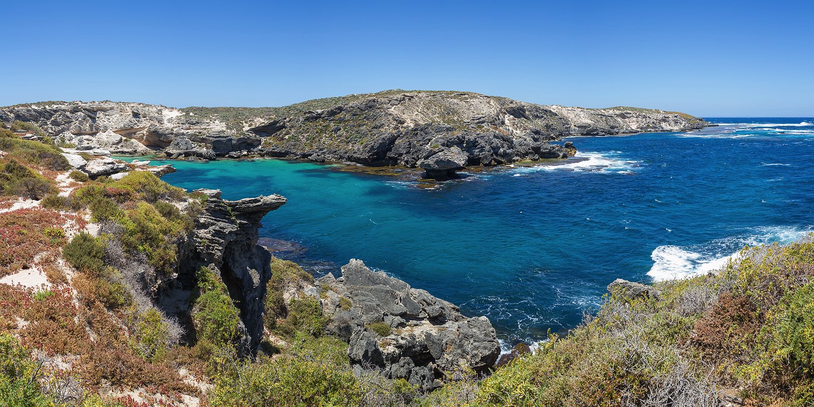
The westernmost point of the island, known for the Cathedral Rocks formation and frequent New Zealand fur seal sightings.
Use binoculars at the platform to spot seals on the rocks.
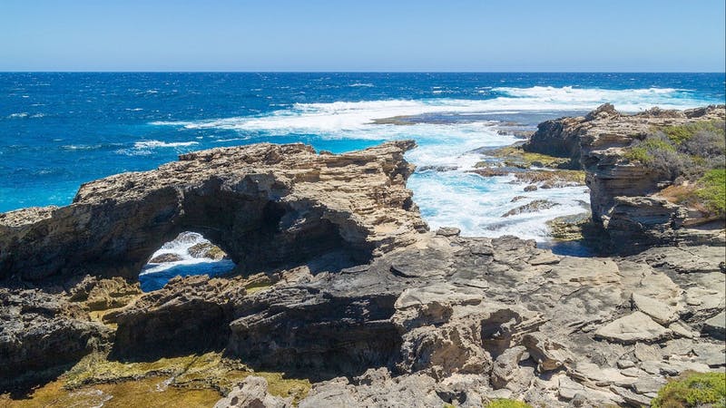
A rugged coastal lookout point providing vantage over the Indian Ocean and the migration paths of humpback whales.
Look south toward the horizon during whale migration season.
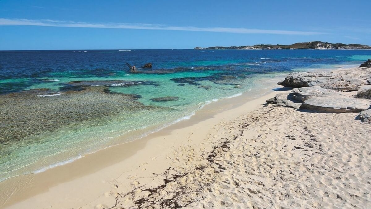
A shallow coastal area featuring the historical shipwreck site of the Shark, visible from the shore.
Walk the boardwalk path for the clearest view of the wreck.
A little preparation in the weeks and days before you sail makes the island's bus route map far easier to use once you land.
Everything you need to know about rottnest island bus tour map
You can access a current rottnest island bus tour map through the official island website or at the visitor center upon arrival. These guides clearly outline the primary transit loops and major island landmarks. Digital versions are also available for download to your mobile device prior to departure. Physical copies are provided by staff when you arrive at the main settlement. While most visitors find the island easy to navigate, having a visual representation of the bus routes ensures you do not miss key coastal stops. The transit network is designed to circulate efficiently around the primary attractions, and the map clarifies the timing for each section. Although the bus provides a convenient circuit, many travelers supplement their journey by walking or cycling. A map helps you identify where transit lines intersect with scenic trails. Specific island stops are marked clearly to show the connection between the settlement and outer reef lookouts. These indicators help visitors coordinate their schedule with ferry departure times. Most visitors find that checking the island website allows them to view updated interactive guides. These digital formats provide the same routing details as physical prints without the need for paper.
Rottnest Island Bus Tour Costs & Pricing
Read more Tickets & toursRottnest Island Ferry and Bus Tour Packages
Read more GuideRottnest Island Bus Tour Reviews
Read more Tickets & toursRottnest Island Guided Bus Tour
Read more GuideRottnest Island Bus Timetable & Route Map
Read more